Pro Tips For Surviving The Extreme Cold In The Quad Cities

Frigid and dangerous cold temps are headed to the Quad Cities this weekend. It's going to be so cold this weekend and next week that we could see wind chill values down into the -20's. Yeah, that cold.
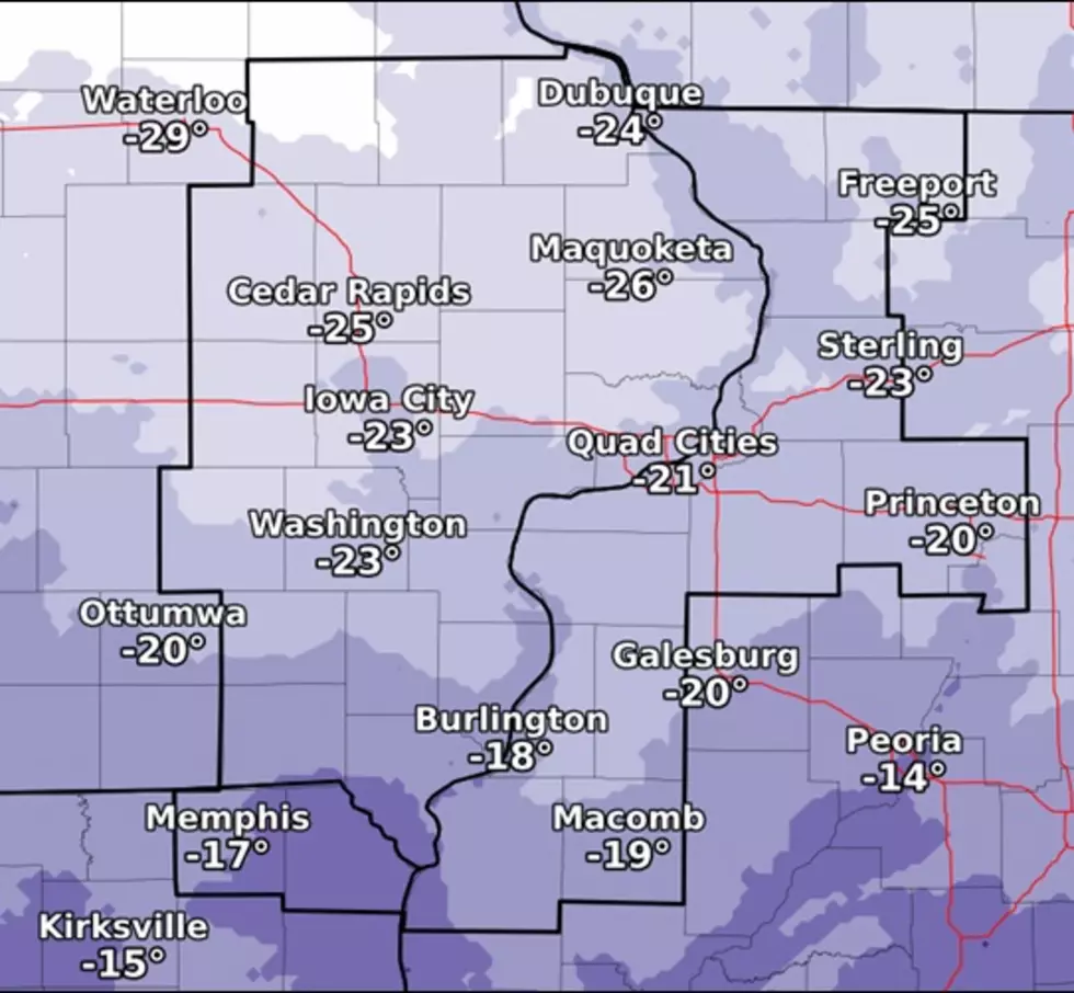
Because extreme cold temperatures are on the way, we have some pro tips to keep you, your loved ones and pets safe. Before we give you some tips to prepare for the bitter cold, here is what the National Weather Service (NWS) of the Quad Cities is forecasting for the weekend and into next week.

After Thursday's storm, temperatures have significantly dropped due to a cold front that followed that storm. This cold front is bringing artic winds that are pushing into our area causing extremely cold temperatures.
Today's (Friday) high is only 14*, and it's going to get a lot colder from here. We are even going to possibly see a couple more inches of snow before we get even colder.
See your 7 day forecast according to the Nation Weather Service below to see what we are expecting in regards to snow and frigid temperatures:
- Tonight
- Mostly clear, with a low around 1. Wind chill values as low as -10. West wind 5 to 15 mph, with gusts as high as 20 mph.
- Saturday
- Snow likely after noon. Increasing clouds and cold, with a high near 8. Wind chill values as low as -15. Northwest wind 5 to 10 mph. Chance of precipitation is 70%. New snow accumulation of 1 to 2 inches possible.
- Saturday Night
- A 20 percent chance of snow before midnight. Mostly cloudy, then gradually becoming mostly clear, with a low around -10. Wind chill values as low as -25. Northwest wind 5 to 10 mph.
- Sunday
- Partly sunny and cold, with a high near 4.
- Sunday Night
- A 30 percent chance of snow before midnight. Mostly cloudy, with a low around -1.
- Monday
- A 40 percent chance of snow. Mostly cloudy and cold, with a high near 10.
- Monday Night
- A 30 percent chance of snow before midnight. Mostly cloudy, with a low around -3.
- Tuesday
- Mostly sunny and cold, with a high near 9.
- Tuesday Night
- Partly cloudy, with a low around -5.
- Wednesday
- Mostly sunny and cold, with a high near 8.
- Wednesday Night
- Partly cloudy, with a low around -5.
- Thursday
- Partly sunny and cold, with a high near 7.
The NWS of the Quad Cities actually has a chart that shows you the amount of time you can be outside ,depending on the air temperature and wind speed, before frost bite will set in.

If Saturday Night's forecast holds up, you will only have about 30 minutes of being outdoors before frostbite will set in. Best piece of advice we can give is STAY INSIDE!
Below are tips to keep you safe when temperatures get dangerously cold here in the QCA. Make sure you download the free B100 app to keep up to date on the weather as our journey through winter continues.
Safety Tips For Surviving the Quad Cities Cold Temps
Essential Winter Emergency Kit Items
More From 97X