A Big Freeze is Coming to the Quad Cities: Get Ready to Bundle Up!
Put on your warmest hats and your fluffiest mittens! Weather experts say a "Big Freeze" is headed straight for the Quad Cities.
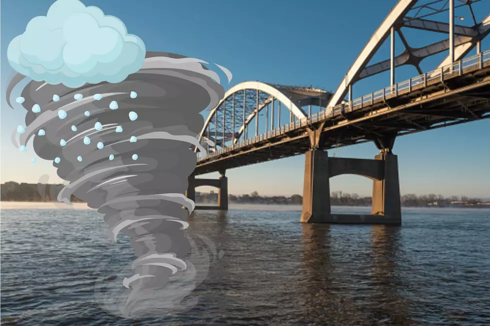
An Arctic cold front will sweep through the Quad Cities on Wednesday afternoon, bringing gusty snow showers and potential travel hazards due to blowing snow. Behind this front, temperatures will plummet well below zero on Friday and Saturday, marking the coldest air of the season so far. Dangerous wind chills between -20°F and -40°F are expected, making it critical to limit time outdoors and protect pets from the extreme cold.
 National Weather Service" loading="lazy" onload="this.parentNode.parentNode.classList.add('frame-loaded');" onerror="this.parentNode.parentNode.classList.add('broken-image');" fetchpriority="low" width="1536" height="864"/>
The National Weather Service (NWS) in Davenport has issued a weather story warning of an Arctic front that will bring the coldest air of the season, creating hazardous conditions for anyone outdoors.
The Forecast: A Major Temperature Drop
According to NWS meteorologists, the transition begins Wednesday evening as an Arctic cold front sweeps through. This front may bring quick bursts of snow—known as snow showers or squalls—which can make visibility disappear in an instant.
Behind this front, the "Big Freeze" begins. By Friday morning, actual air temperatures are expected to fall below zero. In some areas, the mercury may struggle to climb back above the zero-degree mark for the entire day.
 National Weather Service" loading="lazy" onload="this.parentNode.parentNode.classList.add('frame-loaded');" onerror="this.parentNode.parentNode.classList.add('broken-image');" fetchpriority="low" width="1536" height="864"/>
Understanding the "Wind Chill" Danger
The most important part of this forecast is the wind chill. Even if the sun is out, strong winds from the northwest will make it feel much colder than the thermometer says.
- The Numbers: Wind chills are projected to drop between -20°F and -40°F.
- The Risk: At these extreme levels, frostbite can happen to exposed skin in as little as 10 to 30 minutes.
- For the Kids: Think of the wind chill like a giant, invisible ice cube blowing against you. It’s the "feels like" temperature, and right now, it feels like the inside of a freezer!
 National Weather Service" loading="lazy" onload="this.parentNode.parentNode.classList.add('frame-loaded');" onerror="this.parentNode.parentNode.classList.add('broken-image');" fetchpriority="low" width="1536" height="864"/>
Safety Tips: Protecting Your Family and Pets
To stay safe during this Arctic blast, the NWS and local safety officials recommend a "Safety First" approach:
- Be a "Layer Cake": Wear several layers of loose-fitting, warm clothing rather than one thick coat. This traps warm air between the layers to keep you cozy. Don’t forget a hat, mittens (which are warmer than gloves!), and a scarf to cover your face.
- Shorten Outdoor Time: Avoid staying outside for long periods. If you have to go out, make it quick, and come back in to warm up immediately.
- Paws and Claws: If it’s too cold for you, it’s too cold for your pets. Bring dogs and cats inside, and ensure outdoor animals have extra bedding and water that hasn't frozen over.
- Walk Like a Penguin: With the extreme cold, ice on the sidewalks becomes very hard and slippery. Keep your center of gravity over your front leg and take small steps to avoid falling.
- Home Care: To prevent frozen pipes, let your indoor faucets drip slowly and keep your thermostat set to a consistent, warm temperature.
 National Weather Service" loading="lazy" onload="this.parentNode.parentNode.classList.add('frame-loaded');" onerror="this.parentNode.parentNode.classList.add('broken-image');" fetchpriority="low" width="1536" height="864"/>
Looking Ahead
While the most intense cold will grip the region from Thursday night through Saturday morning, weather experts expect temperatures to "moderate"—or get a little bit better—by Saturday afternoon. However, even then, it will remain very cold.
Stay tuned to local weather updates at the NWS Quad Cities website and remember: when the wind begins to howl, it’s time to head inside and stay warm!
Essential Winter Emergency Kit Items
Gallery Credit: Connor Kenney/Townsquare Media Quad Cities
More From 97X